


A hiking app can help plan and navigate but truly knowing how to navigate through the wilderness is one of the most essential skills hikers and backpackers can develop. A hiking app like onX Backcountry, makes the planning and navigation easier for hikers. Being able to rely on a good old fashioned hiking map is always a good backup plan. Today we're going to talk about both methods so that you can adopt a comprehensive navigation system.
Seek Qualified Instruction and then Practice, Practice, Practice!
I will do my best to give you a basic overview for navigating the backcountry. There is only so much that can be transferred in a blog post. If you are serious about becoming your own best resource out there, then it is important to get real-world practice with an expert.
I recommend bribing one of your friends or family-members who have demonstrable navigation skills. You can sign up for a formal navigation class through a local outfitter or agency. Once you are comfortable with the principles of navigation, practice what you've learned in low-risk settings.
Ultimately, there's no substitute for just getting out in the woods with a hiking map and compass in hand, and connecting the dots. A good hiking app can help make the planning phase easier but you should be familiar with backcountry navigation.
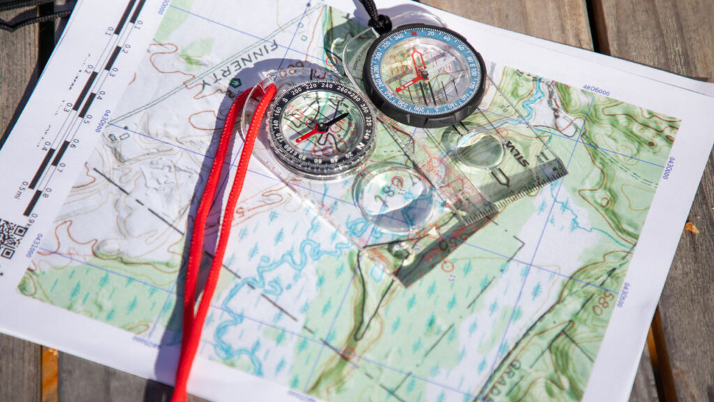
Always Carry a Paper Hiking Map and Compass
Now, when I say “always,” I'm referring to hikes that take you miles from civilization. Hikes into national forests, canyons, mountain passes, etc. If you are simply sticking to a well-marked out-and-back or looped trail in a national/state park, then you'll most-likely be fine with just the day hiking essentials for beginner hikers.
If you get a little mixed up, or want to check the remaining distance, your smartphone will bail you out.
With all of that said, for any kind of advanced treks in which markers can be missed, trails can split, so having a high-quality map is a must. You will find National Geographic or U.S. Geological Survey hiking maps at places such as outdoor shops, ranger stations, national park visitor centers, or online.
Just be absolutely certain that the hiking map in your hand covers the region you'll be hiking through. Sometimes this will mean carrying multiple maps. For instance, I posted some videos recently from the Wind River Range in Wyoming. But the National Geographic map is split into a North and a South version. The trail I took stayed entirely within the North section.
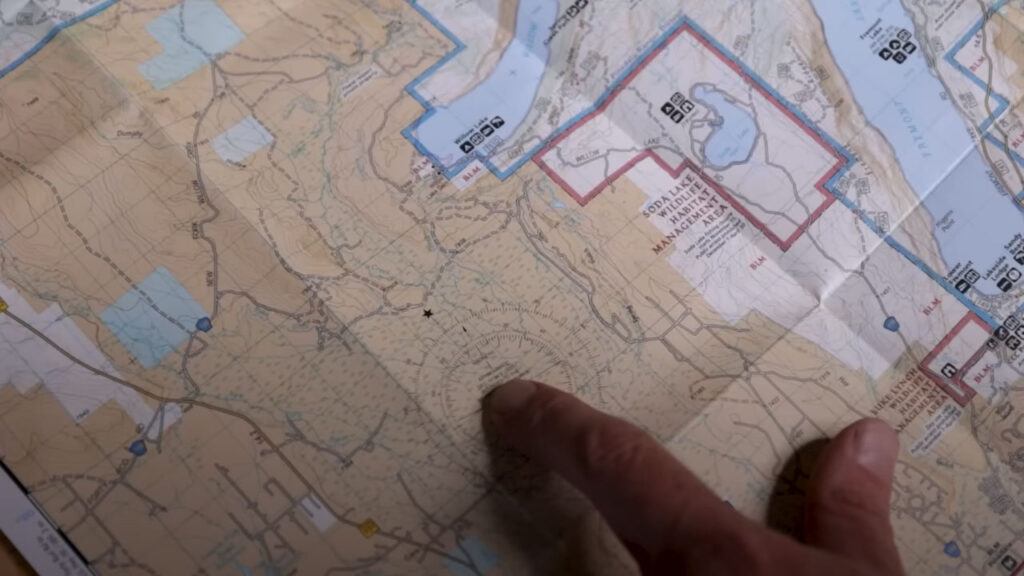
Magnetic Declination
Because True North and Magnetic North are slightly off kilter, it will be necessary to calibrate your compass accordingly. When you open up your map, there should be a little section that you can place your compass on, and then rotate the dial to account for this angular difference. For example, I needed to twist my dial 10-degrees East because of the magnetic declination in the Wind River Range (North).
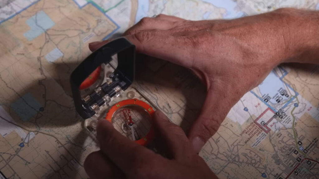
After making this adjustment, I was then able to use my compass and map normally, and know that it was aligned to True North. Though the gap may seem small, it makes a significant difference over large distances.
For a visual representation of how to calibrate for declination, and then physically orient yourself for cross-country navigation (or in the event that you get lost), skip ahead to this section of the video below.
How to Use a Hiking App on Your Phone
It's official, using a smartphone in the backcountry is now common practice. I myself rely on my phone most of the time, but it's important to recognize its limitations. Both cell service and batteries can evaporate deep in the wilderness (and phones themselves can get lost or broken) and so this can't be your only method of navigation – a physical map should reside in your pack. But with that said, let's look into the advantages of a smartphone.
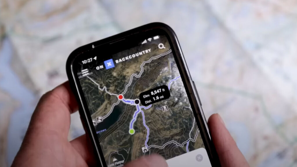
For a while, I was using the CalTopo app. Though I was pleased with what it offered, and do still recommend it to certain people, I just found its layout to be quite technical. Nowadays, I prefer to use the onX backcountry app. This platform blends easy-to-use, intuitive information with some of those technical specs.
OnX Backcountry Hiking App
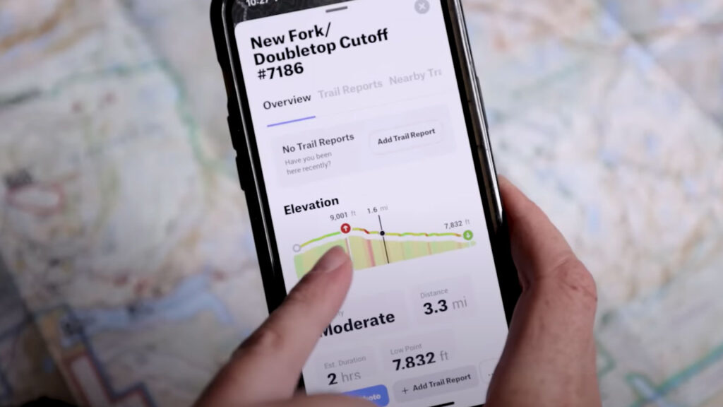
For most people, features such as exact trail profiles will far surpass what a paper map can indicate. For instance, onX lays out the elevation changes in a clear, two-dimensional graph. This delivers a more accurate sense of what the hike will entail in terms of intensity, but also general reference points. If the profile says that the trail rises 3,000 feet in 2 miles but the next half an hour is all flat hiking, then you know you missed a turn somewhere.
OnX also provides trail descriptions, photos, and trip reports from other users. All of these components help me to plan my trips, as well as execute them. I even learn about awesome alternative routes in the same area by scanning around on the map. Often the same handful of popular trails make it into the guidebooks and blogs, but other well-blazed and satisfying hikes go widely unnoticed.
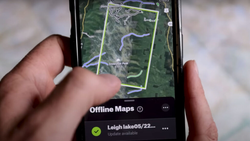
What I find to be the most useful about the onX app is that you can download the maps in advance and then keep your phone on airplane mode while hiking in order to preserve its battery life. Even while offline, the app is still communicating with GPS and gives you very accurate, up-to-date information about your location. I can generally get 3 to 4 days on a single charge if I mostly keep my phone offline.
There are other great trail apps out there, such as AllTrails, Gaia, and Strava, but onX is the one that I have used the most, and can therefore personally recommend.
Don't Solely Rely on Someone Else
Even if you're with an experienced hiker who is confident in their navigation skills and has a map/compass/app, I think it's a good idea to be hands-on in the process. Everybody makes mistakes and two heads are better than one. It's fine to let someone else take the reins, but still bring your own tools, know how to use them, and check them periodically.
This doesn't need to be done with a treasonous tone. Quite the opposite, actually. If you're hiking with someone who knows their way around the backcountry, then ask them to show you how they are navigating. By the end of the trip you will have seriously leveled up as an explorer.
I hope you all found this introduction to navigation helpful. You may want to follow this up with some formal, in-person instruction, but at the very least, you now have a sense of some previously unknown dynamics and variables.
The backcountry is a great place to find yourself, but not if you get physically lost in the process! So empower yourself with more knowledge, and get your hands on some paper maps in conjunction with those fancy apps. Have fun out there and stay the course!
For more instructional aids, gear reviews, and epic adventures, head on over to BackpackingTV.

Gear used in this review includes:
Navigation Apps: onX backcountry, CalTopo app, AllTrails, Gaia, Strava
Clothing: Otero Fleece Full-Zip Hooded Jacket – Men’s


