


Coyote Gulch is a magical slice of paradise in the middle of the Utah desert. It has grown in popularity in the last decade, and with good reason. Full of waterfalls, springs, lush greenery, soaring sandstone cliffs, arches, natural bridges, and even quicksand, this canyon has it all.
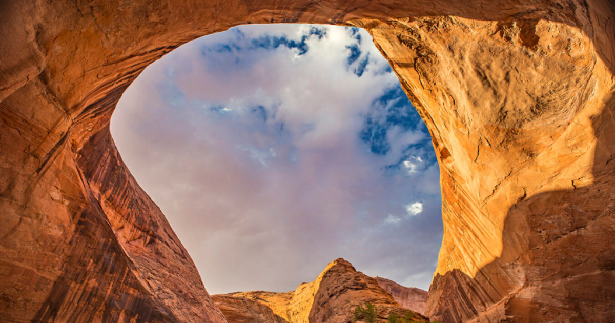
The view from the Crack in the Wall
For those looking for a multi-day backpacking adventure through paradise, here's how to do it.
Although the access to Coyote Gulch is through Grand Staircase-Escalante National Monument, the canyon is actually located in the Glen Canyon National Recreation Area. Permits are required for all overnights and can be acquired at the BLM ranger station in Escalante, Utah.
A few miles east of Escalante lies Hole-in-the-Rock Road, a fifty-mile long road through Grand Staircase that leads to many wonderful treasures. From here, there are a few route options and trailheads for Coyote Gulch. Bear Foot Theory has some great resources on trailheads options.
A popular route option is known as the Crack in the Wall. To do this, park your vehicle at the Water Tanks trailhead, where you’ll begin and finish your trip.
To get here, drive south on Hole in the Rock Road for 36 miles. Turn east (left) on Forty Mile Ridge Road and drive seven miles. You’ll see large water tanks. This is the trailhead. From here, hike 4.5 miles across exposed desert following a 4×4 road (This road can be driven, but the sand is very deep. You’ll likely get stuck without a serious off-road vehicle.) At the end of the jeep track, you’ll see signage. From here you're following cairns across slickrock. At this point you should see signs of the cliff you’ll soon be descending via the Crack in the Wall. Across the canyon is the impressive Steven’s Arch.
The Crack in the Wall is a fun feature, a literal crack in the cliff that can be descended or ascended. It’s tricky, but in a playful, non-intimidating way. The “crack” is very narrow and cannot be squeezed through while wearing a pack. Bring about twenty feet of webbing or cordage to lower your gear down a cliff so you can freely move through the crack.
And now, my friends, you are in the spectacular canyon of Coyote Gulch. The from here is quite stunning, with a large monolith of rock, goosenecks in the canyon, and a the iconic Steven's Arch. It's one of my favorite areas in Utah.
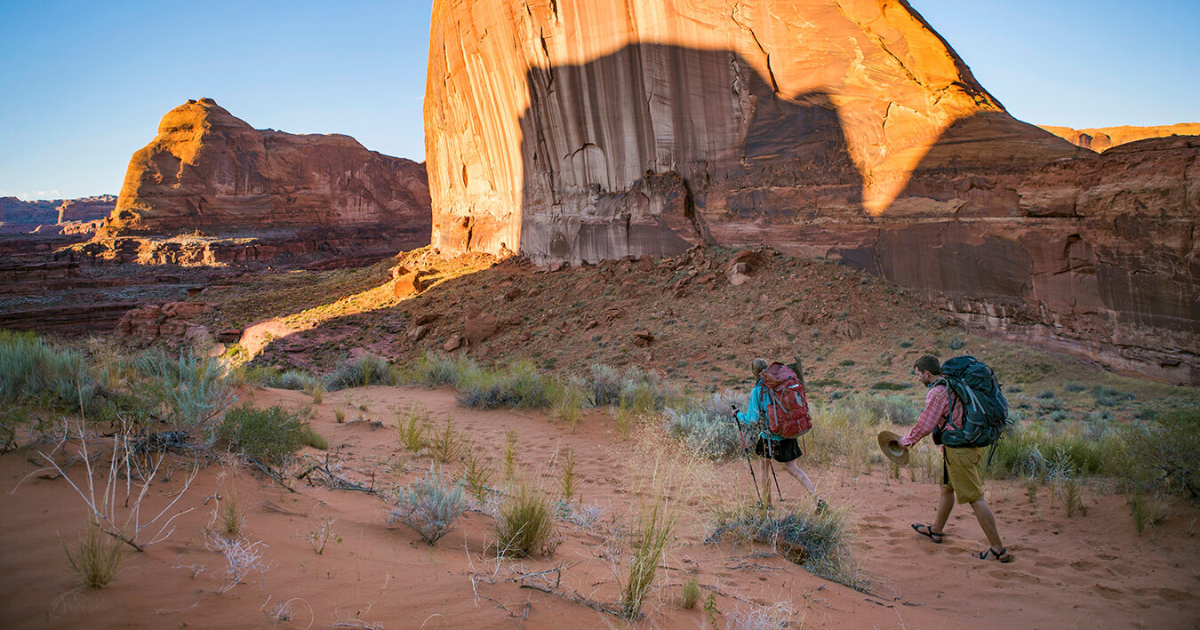
The trail drops down a very sandy trail to the bottom of the Coyote Gulch. From here, there are sporadic trails along the sides of the canyon. But navigation requires mostly river hiking. Bring adequate footwear, as water, mud, and quicksand will be your new constant companion.
Turning left (upcanyon) will lead you through miles of variable beauty.
When I did it, I spent my first night camped under a beautiful alcove just above a great swimming hole. There are a dozen good campsites along the way. But this one was particularly great. The next morning, we spent our time leisurely sipping coffee and swimming in a pool with a gentle cascade. We benefited greatly from having three days to do about fifteen miles of hiking. It meant we could go at a very slow and pleasant pace, spending time at every great spot (and there are many).
Continuing up-canyon, you’ll pass several waterfalls, including a spring-fed waterfall that's feeding into the canyon. Most of the waterfalls are like my mom: short, but very pleasant.
Spring, summer, and fall are amazing here as it’s warm (even hot) and the water presents perfect opportunities to swim and cool off.
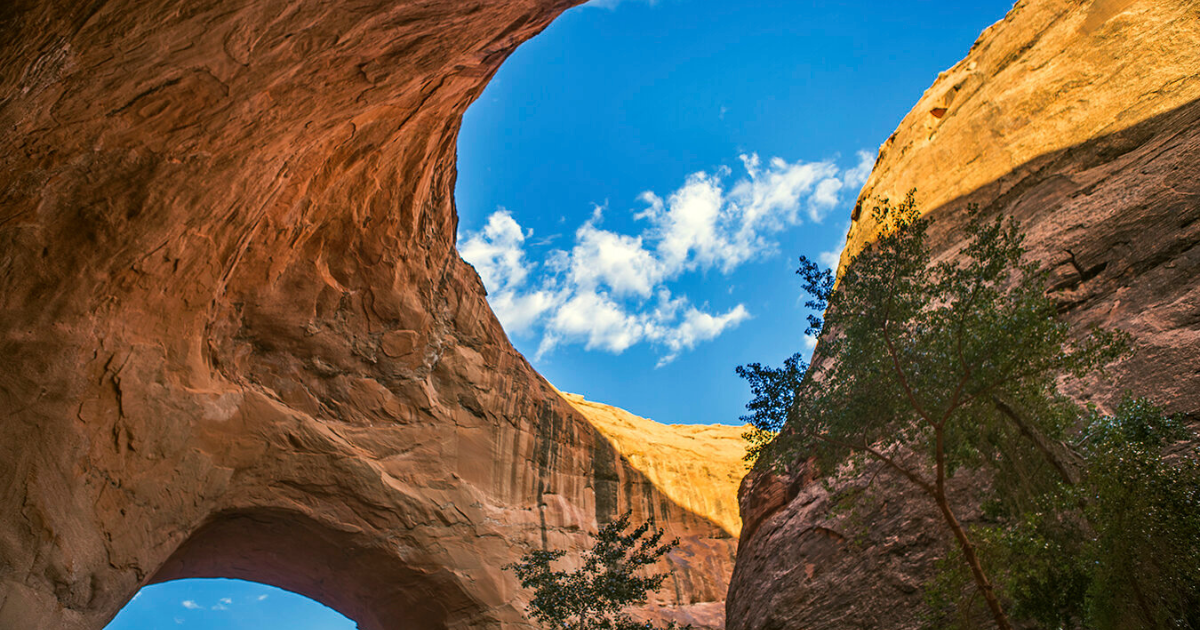
There are many treasures in Coyote Gulch. But the feature that makes this canyon so famous is the Jacob Hamblin Arch and the two massive alcoves that helped create this spectacular feature. Here, the canyon takes several dramatic 180 degree turns, carving deep alcoves into the cliffs. The canyon snakes back on itself and has eroded out the massive and beautiful arch. There are several campsites in this area, and they are all wonderful (although a bit overused).
The exit the canyon just down-canyon of Jacob Hamblin Arch. The exit is not your typical trail. The canyon walls mellow out, losing their verticality, and at one point create a slick-rock ramp that can be ascended and descended.
This is generally the trickiest and scariest part of the whole trip. The slope is about 45 degrees in pitch and can be a little intimidating. But people of reasonable fitness and comfort with heights and scrambling skills can hike in and out without using a rope. If you are really uncomfortable with several hundred feet of 45 degree rock, just go slowly and pick your way up carefully. Maybe bring a friend who can lend a hand.
From the top of the slope, it's just two miles across the bare desert following cairns to get back to your car at the Water Tanks.
Give each other high fives and hopefully you have a couple cold beers packed on ice at your car.
Logistics and notes:
-
Seasons: The ideal seasons are spring and fall. Summers are quite hot, but it can be done (we hiked in August). This could in theory be done in winter, but I'm not sure I'd want to!
-
Bring plenty of water, at least three liters. The desert is unforgiving, especially in summer. Bring a water filter. There is a perennial water source in Coyote Gulch which can be filtered. The water is quite silty. Relying on iodine or similar water treatment tabs means you'll be chewing lots of dirt.
-
You will be constantly hiking in water. I like Chacos for a scenario like this. But it's a good idea to bring a pair of actual shoes too. My feet got a bit chewed up in my Chacos after miles of dealing with the mud and pebbles that kept finding their way under my footbed.
-
Bring about 15 feet of webbing or rope to haul your pack in and out of Crack in the Wall. You cannot fit in the crack with your pack on.
-
Poop. What do you do? Wag Bags, a.k.a. poop in a bag. You gotta carry that *ish out. Coyote Gulch has too much traffic to allow for digging catholes. It would NOT be a pretty place. Stop into the ranger station in Escalante and check in to secure your permit and get free Wag Bags.
-
Hole in the Rock Road is a looooong dirt road that can be driven by most vehicles when the road is in good shape. But after storms, who knows? Flash floods may have caused damage or made the road significantly muddy. Four wheel drive and high clearance should do the trick in most cases.
-
There are no fires allowed in Coyote Gulch
-
There are no dogs allowed in Coyote Gulch.
-
The ranger station is a great place to get road conditions and a local weather report. Call ahead at (435) 826-5499. This is where you’ll get your permits and Wag Bags.


